Vertical
We made the summit of Mt. Hood on 05.17.2012!

Joel Bornzin on the Summit of Mt. Hood 05.17.2012 – Picture taken by James Garrigus

ef=”https://joelbornzin.files.wordpress.com/2011/01/the-view-from-the-99-switchbacks-at-sunrise-of-the-summit-day.jpg”> Mt. Whitney in the AM on the 99 switchbacks. Picture taken by Joel Bornzin 9.2010[/cap
On the summit of Mt. Whitney! We made it!

At the top on Mt. Whitney! What a view from 14505ft! Joel Bornzin 9.2010
I completed a two day rock climbing course out in Joshua Tree with Vertical Adventures. I continue to make progress towards my personal climbing goals.

James and I on the Mt. Whitney Trail 9.2010

On the Mt. Whitney Trail, view of alpine lake. Picture taken by Joel Bornzin 9.2010.
05.17.2012 Mt. Hood summit via the South Side Route.
You can see my blog post wrap up of the trip HERE –

Joel Bornzin on the Hogsback Mt. Hood – Picture taken by James Garrigus
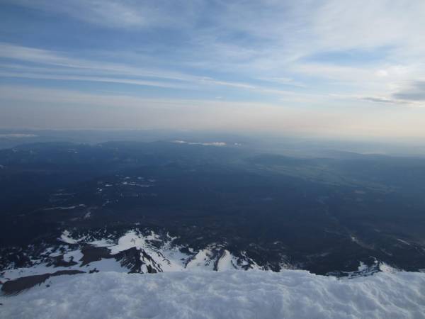
es.wordpress.com/2012/05/img_0909.jpg”> Mt. Hood Summit View – Picture taken by Joel Bornzin
08.
[/caption]08.27.2011 South Sister
View from West Side of Summit Ridge of Middle Sister + North Sister.
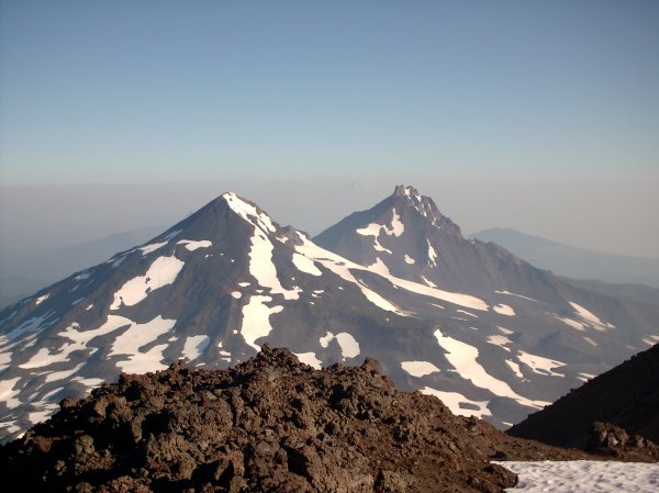
press.com/2011/08/imag0009.jpg”> Views from West Side of Summit Ridge South Sister Climbers Trail 36 08.27.2011 Taken by Joel Bornzin
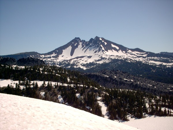
[caption dth="600" href="http://joelbornzin.files.wordpre id="attachment_2026" alt="" width="600" height="450"]s.com/2011/07/imag0042.jpg”> View of South Sister on Cascade Lakes Highway taken by Joel Bornzin 07.23.2011
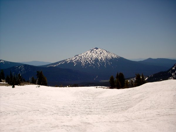
[caption href="https://joelbornzin.files.wordpress.com id="attachment_2024" alt="" width="600" height="450"]2011/07/imag0054.jpg”> View of Mt. Bachelor from Trail 36 – South Sister by Joel Bornzin 07.23.2011
Here is a cool picture I took of Mt.
[/caption]Here is a cool picture I took of Mt. Baldy view taken on 02.05.11 when we were up on Mt. Baden Powell’s summit ridge.
2.05.20112.05.2011 Mt. Baden Powell (9407 ft 2867m) Winter training ascent via the Vincent Gap Trail, turned around at 9300ft (summit ridge) due to energy level expended from deep snow climb. Climb smart! The mountain summit will always be there for another day! Man, my legs are hurting today![/caption]1.09.2011 Mt. Baden Powell (9407 ft 2867m) Winter ascent via the Vincent Gap Trail, did not summit due to snow conditions, turned around at 8600 ft.
9.11.2010 Mt. Whitney (14,505 ft 4421m) Summited via Whitney Portal Trail. Highest peak in the lower 48 states. Only one peak higher in the USA (Denali in Alaska). This was a major accomplishment. I cherished every moment we were on that mountain. We did it over two nights and three days in order to acclimatize ourselves safely. It was a great experience, a lifetime experience! I swear you could almost see the curvature of the Earth!
9.6-9.8.2010 Mt. San Jacinto (10,834 ft 3302m) Summited via Palm Springs Aerial Tram Trail. I spent three nights at Little Round Valley Campground. I spent days at the summit reading in the shade relaxing, and just acclimatizing at 10,800 ft. for the Mt. Whitney trip that coming weekend. It was so peaceful at the top, especially in the evenings when there far less people up there.
On 9.7.2010 I awoke in my tent in the dead silence of the high mountain camp at around 3:30am to a major cat fight happening. It sounded like a very aggressive alley cat fight in L.A. I concluded that it must have been either two California Bobcats fighting, or one Bobcat fighting with something else. Either way, it was really loud and quite unnerving. After a few minutes things calmed down and the dark meadow area slept again. The whole time I was at Little Round Valley Camp there were only two other parties there, or none at all. It was isolating, away from the clutter of the world, and a perfect way to prepare mentally for Mt. Whitney. I loved it.
7.31.2010 Mt. San Jacinto (10,834 ft 3302m) Summited via Marion Mountain Trail
7.17.2010 Mt. Baden Powell (9407 ft 2867m) Summited via Vincent Gap Trail
7.3.2010 – Mt. Baden Powell (9407 ft 2867m) Summited via Vincent Gap Trail
6.11.2010 – Mt. San Antonio (Baldy) (10,068 ft 3044m) Summited via Manker Flats Loop Ski Hut Trail
5.30.2010 – Mt. Baden Powell (9407 ft 2867m) Summited via Vincent Gap Trail
5.15.2010 – Throop Peak (9138 ft 2785m) Summited via Dawson Gap Trail
5.01-02.2010 – 2 Day Intensive Rock Climbing School with Vertical Adventures. I climbed the Nutcracker (5.2) in Joshua Tree National Park.
5.01.2010 – Ryan Mountain Joshua Tree National Park (5461 ft 1638m) Summited via Ryan Mountain Trail, amazing view of hundreds of miles of Joshua Trees. Not to be missed, a real treat in SoCal.
2009 – I don’t seem to have many pictures or dates from the 2009 hiking season. I’ll ask James. I know we did Mt. San Gorgonio, Mt. San Jacinto, and Mt. San Antonio (Baldy) in 2009. Here’s a picture of us coming down the Devils Backbone Trail at about 9,800 feet on Mt. Baldy. The stark contrast in the clouds that high up were a sight to see that day!

Coming down the Devils Backbone Trail on Mt. Baldy (San Antonio) July 2009
Los Angeles is not known for it’s hiking…it should be!

Los Angeles Mountains photo by Gary Conner via Weblink @ City Data
Support the Angeles National Forest here.

Joel Bornzin
